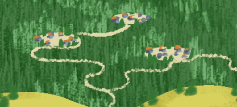
Community Defense Against Wildfire
Our communities in the west are vulnerable to wildfire during drought conditions, especially as the impacts of climate change increase. We work to provide adaptation solutions to wildfire hazards.
u003cspan style=u0022font-weight: 400;u0022u003eJust one year ago on December 30, 2021, the Marshall Fire swept through the City of Louisville, Town of Superior, and unincorporated Boulder County, destroying and damaging more than 1,000 homes and over 30 commercial structures. In terms of structures lost, it was the most destructive fire in Colorado history. Wildfire risk isn’t just limited to forests and mountains and this event could be just a preview of how future events could impact city suburbs and infrastructure. For example, the Marshall fire rekindled concerns that parts of the electrical grid might be under increased risk amid drought and rising temperatures that will continue to warm and dry the state into the future. Those patterns will only intensify as human activities add greenhouse gases into the atmosphere, further priming the landscape for extreme fire behavior and extending fire seasons. Nearly 3 million Coloradans live in fire-prone areas, referred to as the wildland-urban interface or WUI. That’s about half the state’s population.u003c/spanu003ernrnu003cspan style=u0022font-weight: 400;u0022u003eLynker has just been awarded a contract to examine the risks of wildfire to, and posed by, the City of Louisville’s public lands in and around the City, and identifying opportunities for wildfire mitigation in order to be more resilient in future events. We are very much looking forward to working with the City on this important project.u003c/spanu003e
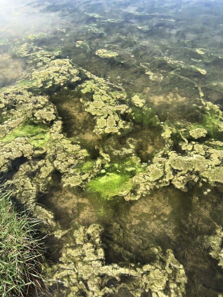
Algal growth that causes hypoxic or toxic conditions are often referred to as harmful algal blooms (HABs), which are a public health concern. There are multiple ways to define HABs, but generally blooms are considered harmful when they (1) contain toxin producing algae and/or (2) are dense enough to deplete oxygen in the water. It’s important to know when HABs are occurring in our ponds and reservoirs but monitoring is typically based on visual observations, so the frequency of reporting is dependent on staff availability and cost.
Lynker worked with City of Boulder Open Space and Mountain Parks (OMSP) to monitor HABs in OSMP’s waterbodies using a combination of remote sensing and in situ sampling. We used two algorithms to track the prevalence of algal blooms and cyanobacterial outbreaks in Boulder County waterbodies. The NIR:Red measures the reflectance ratio between the near infrared and red bands to detect the presence of possible algal blooms on surface waterbodies. The dual-threshold Floating Algae Index (FAI) and Normalized Difference Water Index (NDWI) rule-based algorithm was used to indicate possible cyanobacterial blooms on surface waterbodies. This project accessed data from Landsat 5, 7, and 8 and the Sentinel 2A/2B satellites via Google Earth Engine to conduct the remote sensing assessment.
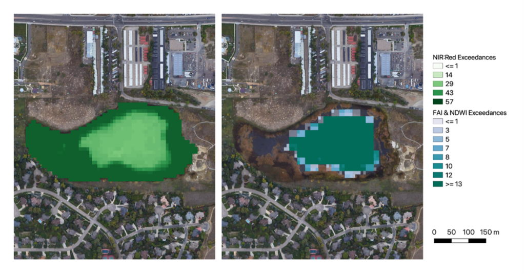
Results from this study revealed Sentinel 2A/B satellites were most effective in identifying water surface algae presence and spatiotemporal dynamics. In Sombrero Marsh, NIR:Red outputs reveal algae presence was observed most frequently near edges, which is typical of algal growth patterns. The FAI-NDWI results indicate potential cyanobacterial blooms were most observed in the center of the marsh (Figure 1).
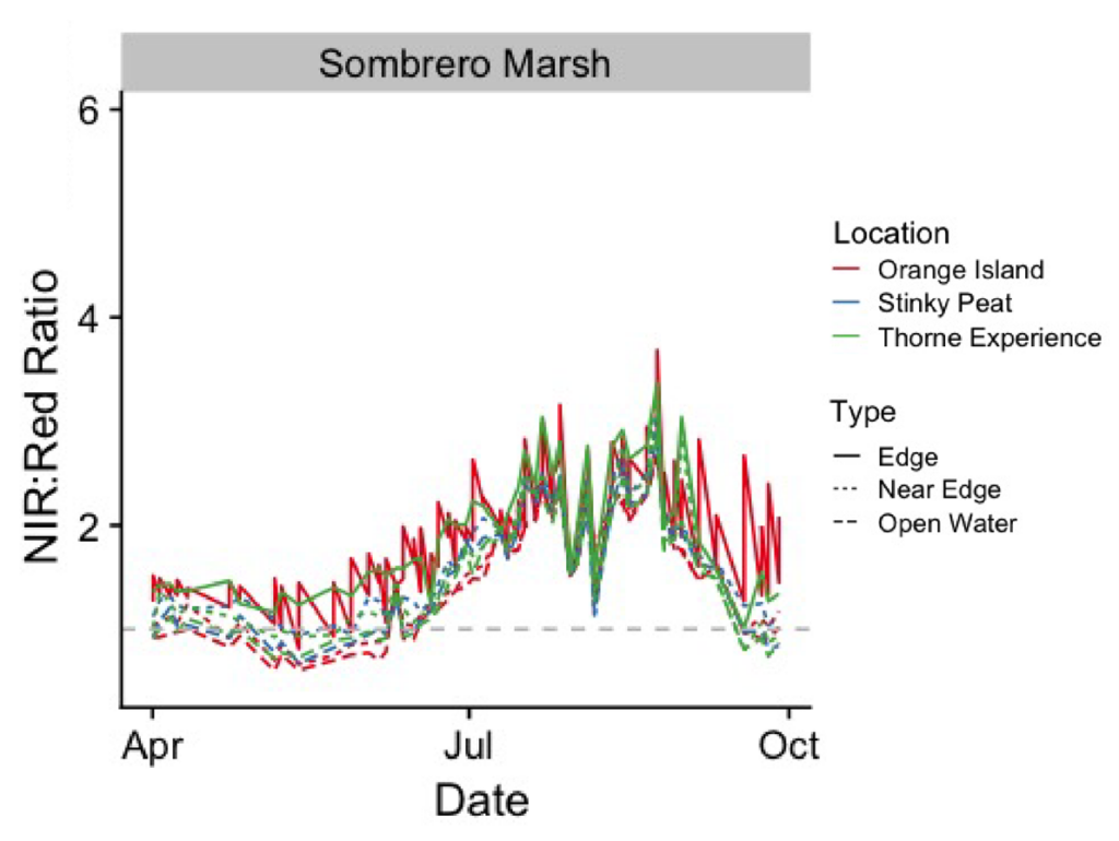
The NIR:Red timeseries show data collected about every 5 days throughout the 6-month study period (Figure 2). We categorized image processing using three types of points for each waterbody (Edge, Near Edge, and Open Water) to remove the potential influence of shoreline vegetation. At Sombrero Marsh, NIR:Red peaked in the late summer, revealing a seasonality to algal growth.
Remote sensing results from this study provided guidance for the management of Boulder OSMP waterbodies. By documenting algal growth in near real time, we can provide water managers with the information necessary to protect the community. With the growing impacts of climate change, HAB monitoring is essential to protect water resources and public health.


Our communities in the west are vulnerable to wildfire during drought conditions, especially as the impacts of climate change increase. We work to provide adaptation solutions to wildfire hazards.

The potential impacts of drought on communities is clearly visible in the dropping reservoir level at Lake Meade and Lake Powell in the Colorado River basin. We work with municipalities to identify and forecast the magnitude and severity of droughts from a water system perspective.
related capabilities
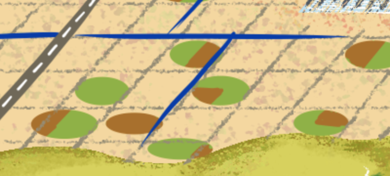
Irrigation for agriculture is supplied by surface water and groundwater sources, both of which are impacted by drought through different mechanisms. Drought may motivate the leasing of water, sale of cattle, or decision on whether to plant for the season. We provide geospatial solutions to analyze drought impacts while considering future climate change.
related capabilities
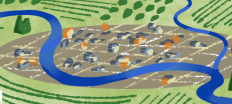
Flood hazards present profound risks to both life and property. We combine localized impact data along with cutting-edge forecast models to help communities and business plan for, respond to, and adapt to flood hazards.
related capabilities

Rising sea levels and accelerated coastal erosion due to climate change present major risks to urban coastal areas and infrastructure. We can provide modeling solutions to guide mitigation planning efforts to proactively protect life and property.
related capabilities

Climate change, overfishing, and industrial development are leaving a lasting impact on our world’s fisheries. Sustainable fisheries are a necessity for the next generation populating our coastal communities. Lynker Intel can help guide decision makers in protecting and encouraging growth of this valuable natural resource.
related capabilities

Earthquakes can abruptly and catastrophically damage unprepared urban areas. Lynker Intel can provide customized risk assessment and hazard mapping to help local leaders prepare for the unexpected.
related capabilities

Increased temperatures present our urban population centers with unique challenges. Infrastructure decisions made by previous generations need to be reevaluated and updated to mitigate the effects of climate change. Lynker Intel can help identify problem areas such as heat islands to improve public health and quality of life.

